Janus Portable Geostationary Antenna and Display
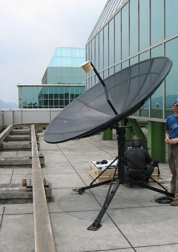
Janus is a portable geostationary satellite ground station that collects, processes and displays LRIT or full-resolution meteorological satellite imagery in the field. It is built for rapid deployment by military, meteorological and disaster-relief teams operating in remote locations.
- Setup time
- < 15 minutes (antenna and processing unit)
- Data format
- LRIT or full-resolution
- Satellite compatibility
- MTSAT, FY-2, COMS, GOES East and West
Overview
In detail
How it works
The Janus ground station collects, processes and displays LRIT or full-resolution data from geostationary meteorological satellites, including MTSAT, FY-2, COMS, and GOES East and West. It provides all of the hardware and software needed to collate and analyse satellite meteorological data on the go, as a turn-key system.
Deployment
Both the antenna and the processing unit can be assembled and made operational in under 15 minutes. Each unit is transported in a rugged, durable transit case, making the system suited to swift deployment by military, meteorological and disaster-relief organisations in remote locations.
Reach out and say hi
Let us help. Tell us the site, the range you expect and what it has to talk to, and we’ll work out the right variant, cable and mounting — and quote it.
Specifications
Technical specifications
- Setup time
- < 15 minutes (antenna and processing unit)
- Data format
- LRIT or full-resolution
- Satellite compatibility
- MTSAT, FY-2, COMS, GOES East and West
Related
Often specified alongside
Weathertech
X-LAS MkII Scintillometer
- Path length
- 1 to 12 km
- Dimensions
- 1010 x 552 x 426 mm (with sunshield) 18,75 kg
- Wavelength
- 850 nm
- Range
- 0-100,000 µS/cm ±2%
Ready to specify?
Add Janus Portable Geostationary Antenna and Display to your enquiry
Build a list, add your site notes, and an ESS engineer will quote the lot — cables, mounting and calibration included.