
Two years on from Victoria’s largest earthquake
Two years ago today, at 9:15 am, a few million people in southeast Australia felt an earthquake, many for the first time in their lives. Let’s cover some of the more interesting points about this earthquake. Despite being felt by millions of people, only about 43,000 reported what they experienced…
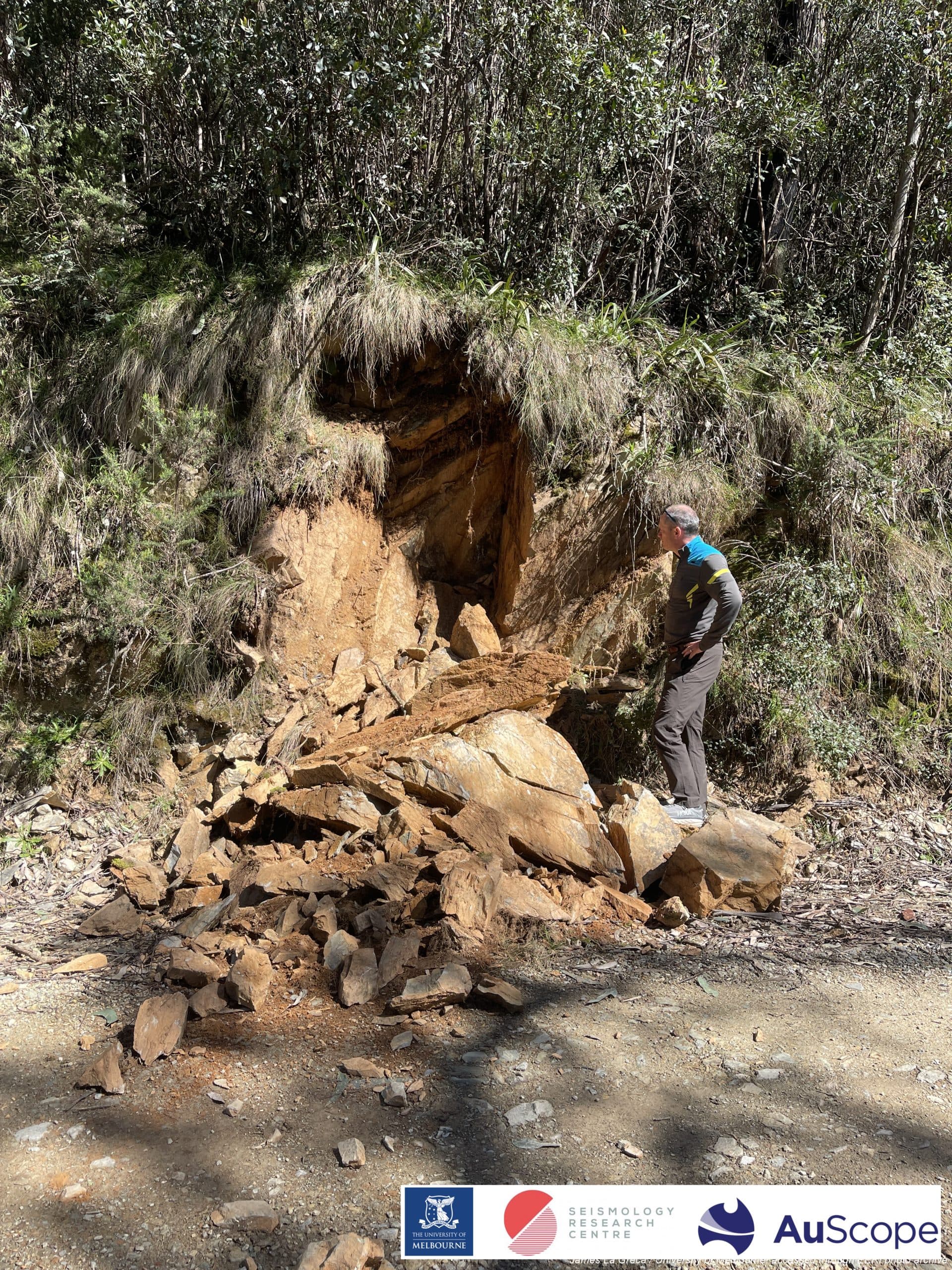
Two years ago today, at 9:15 am, a few million people in southeast Australia felt an earthquake, many for the first time in their lives. Let’s cover some of the more interesting points about this earthquake.
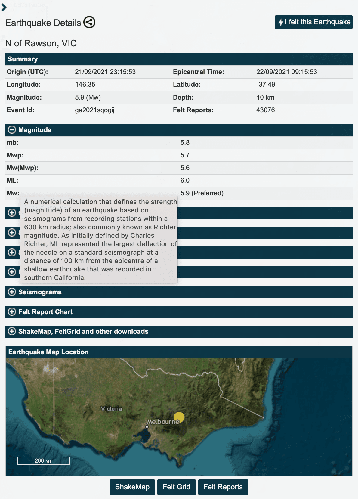
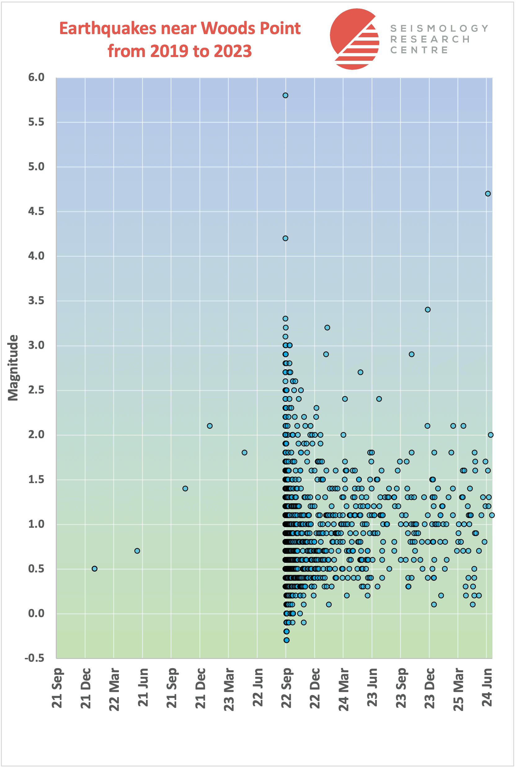
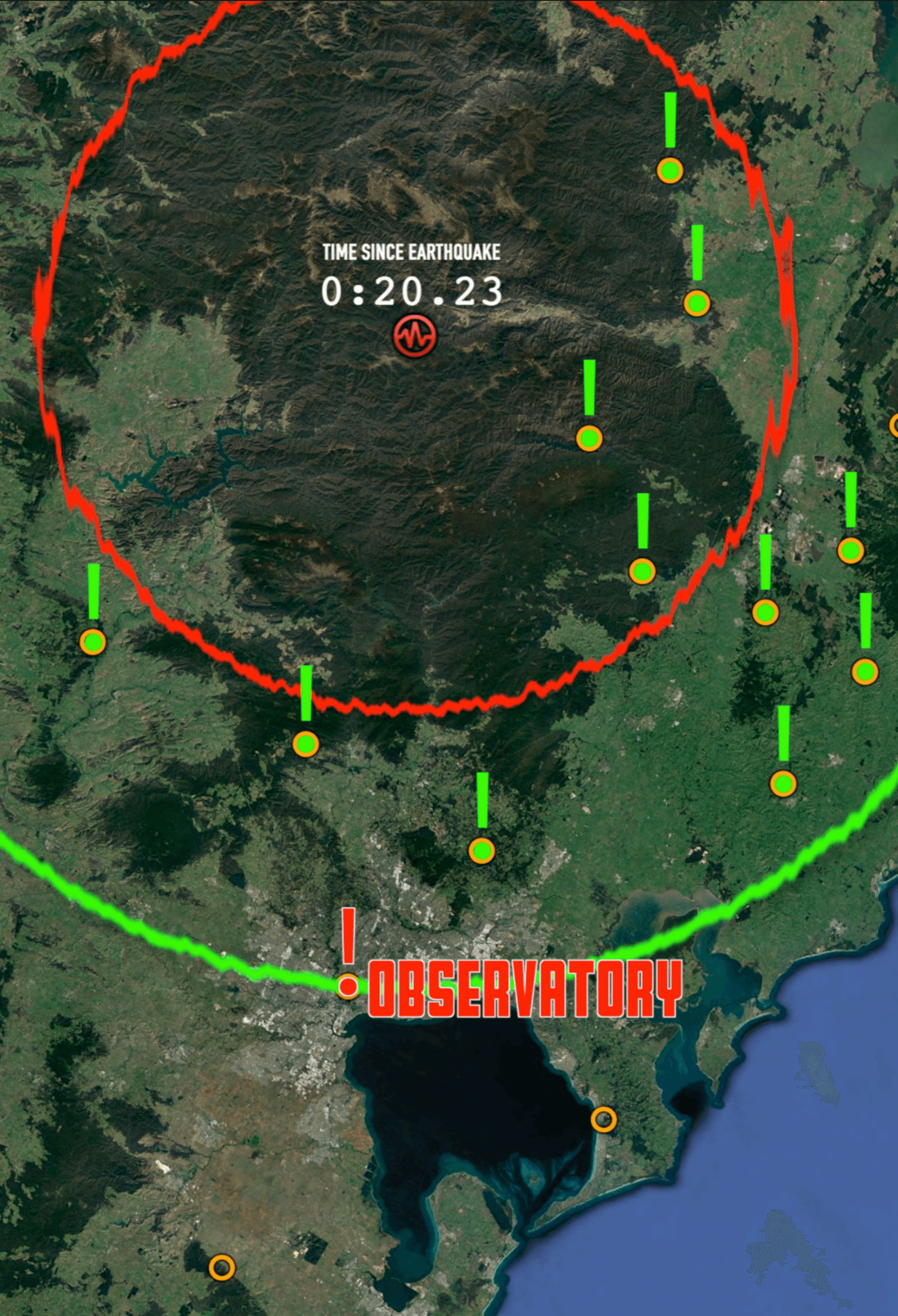

- The earthquake was assigned a Moment Magnitude of 5.9, but the equivalent local Richter magnitude for this earthquake is 6.0
- It’s the largest earthquake ever recorded in Victoria, and the largest earthquake within 150km of a capital city since the magnitude 6.5 earthquake that destroyed Meckering in 1968, which was located about 110km east of Perth in Western Australia
- The epicentre was about half way between Mount Buller and Mt Baw Baw, two popular ski destinations in the Victorian Alps, which are mountains formed by millions of earthquakes over millions of years
- Despite being initially reported to have occurred at Mansfield, the epicentre was over 50km to the southeast, near the town of Woods Point
- The primary energy waves took about 20 seconds to reach Melbourne, followed 15 seconds later by the stronger secondary waves that rattled buildings for 20-30 seconds
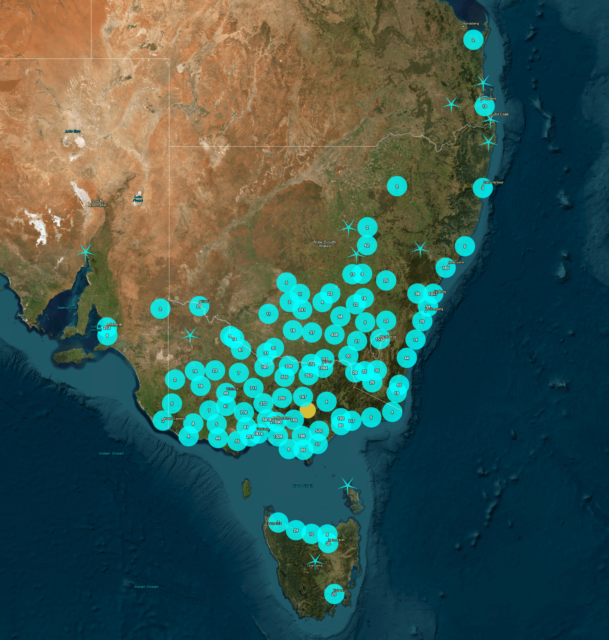
- The earthquake was felt in Hobart, Adelaide, Sydney, and even in Brisbane and beyond, up to 1400km from the epicentre
- That’s because earthquake energy waves travel further where the crust is older and more dense, which is the case in Australia which is a relatively stable area in the middle of a tectonic plate.
- There was very little damage in Woods Point and the surrounding towns, but 130km away in Melbourne the lower frequency energy waves resonated in some areas causing chimneys to topple, along with an unreinforced masonry wall in a normally busy area of Prahran. Fortunately the streets were almost empty due to Melbourne’s COVID lockdown, likely saving people from injury or worse.
- The fault that ruptured during the earthquake was a strike-slip fault, which is a less common type of fault in southeast Australia
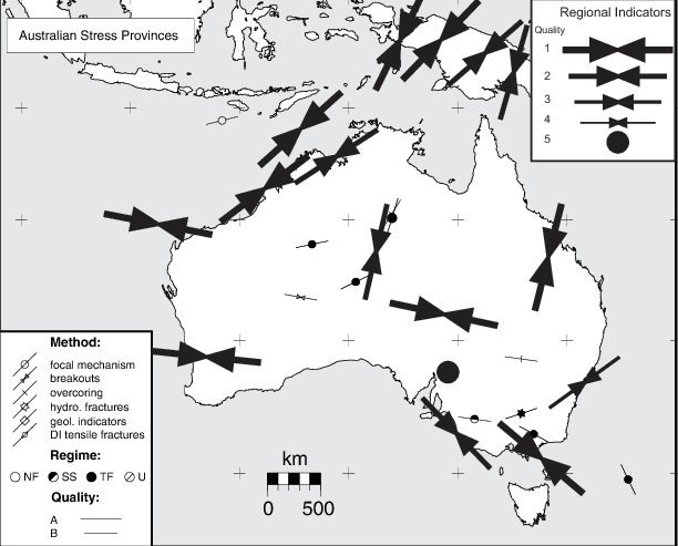
- This horizontally shearing fault aligned with the region’s southeast-to-northwest compressional stress, rather than the more common reverse faults we see in Southeast Australia that are aligned across the stress field, where earthquakes can create an uplifted scarp above the fault
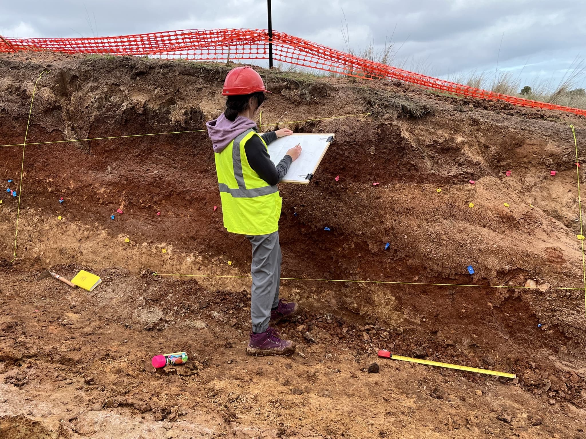
- The rupture area for a magnitude 6 earthquake is about 100 square kilometres, roughly 10km long by 10km deep, but this earthquake originated around 13km below the surface, so was no obvious rupture visible at the surface
Despite being felt by millions of people, only about 43,000 reported what they experienced during the earthquake to Geoscience Australia, so next time there is an earthquake, do your bit for science and fill in a “Felt Report” in the top right of GA’s earthquake page.
Monitoring something similar?
Tell us what you are trying to measure
Describe the site and an ESS engineer will specify the instrument set — usually in one reply.