
Largest Earthquake in Victoria’s history
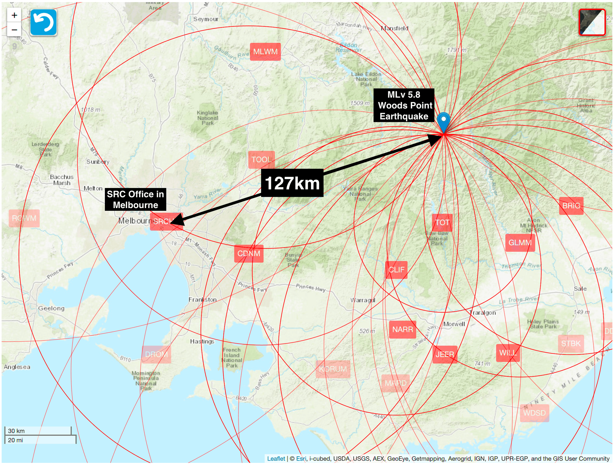
The magnitude MLv5.8 (Mw5.9) earthquake on 22 September 2021 at 9:15am local time was the largest to occur in the state of Victoria since record-keeping began around 200 years ago. The epicentre of the earthquake was located 127km from our office in Melbourne, and was recorded on an old digital…
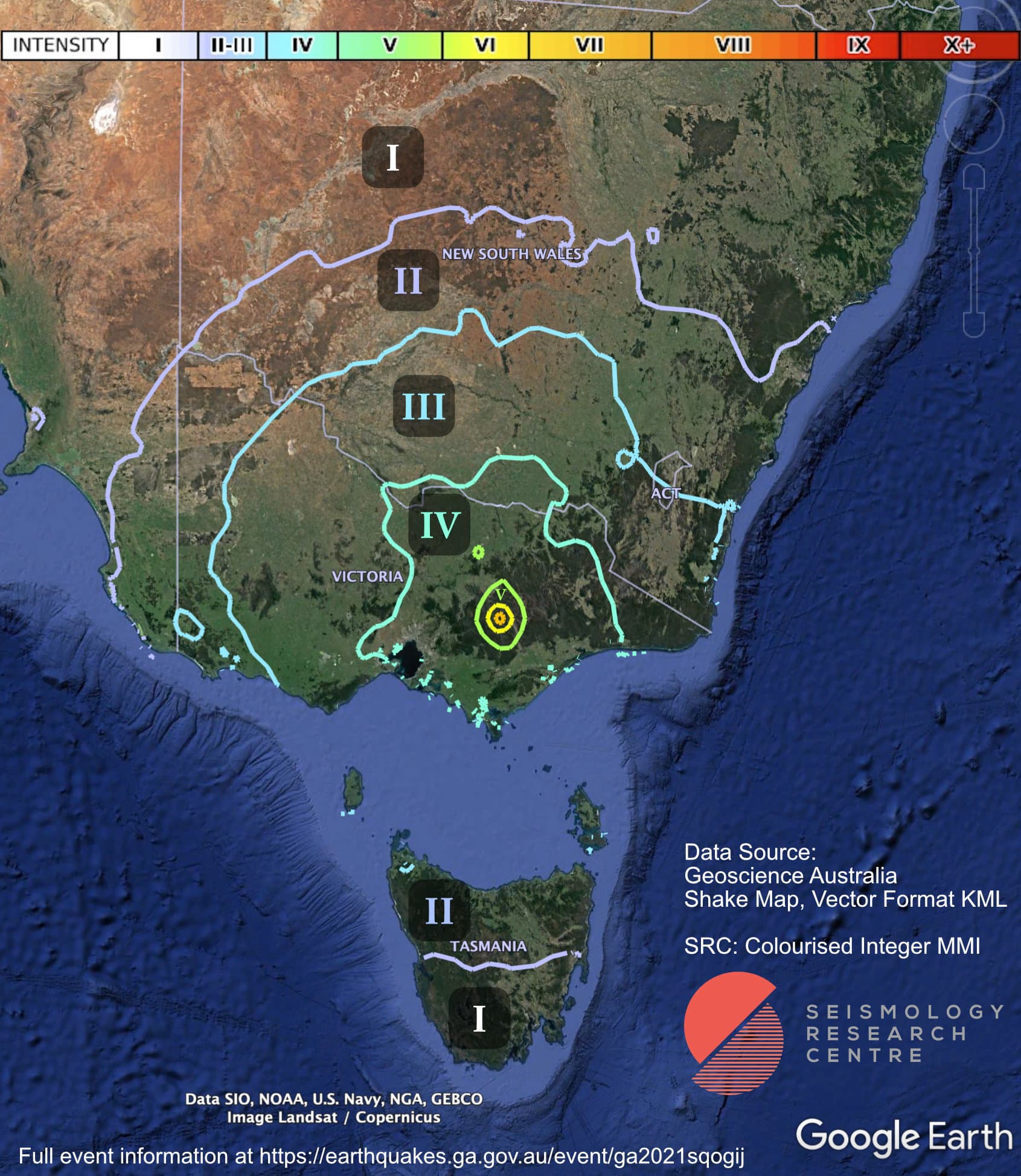
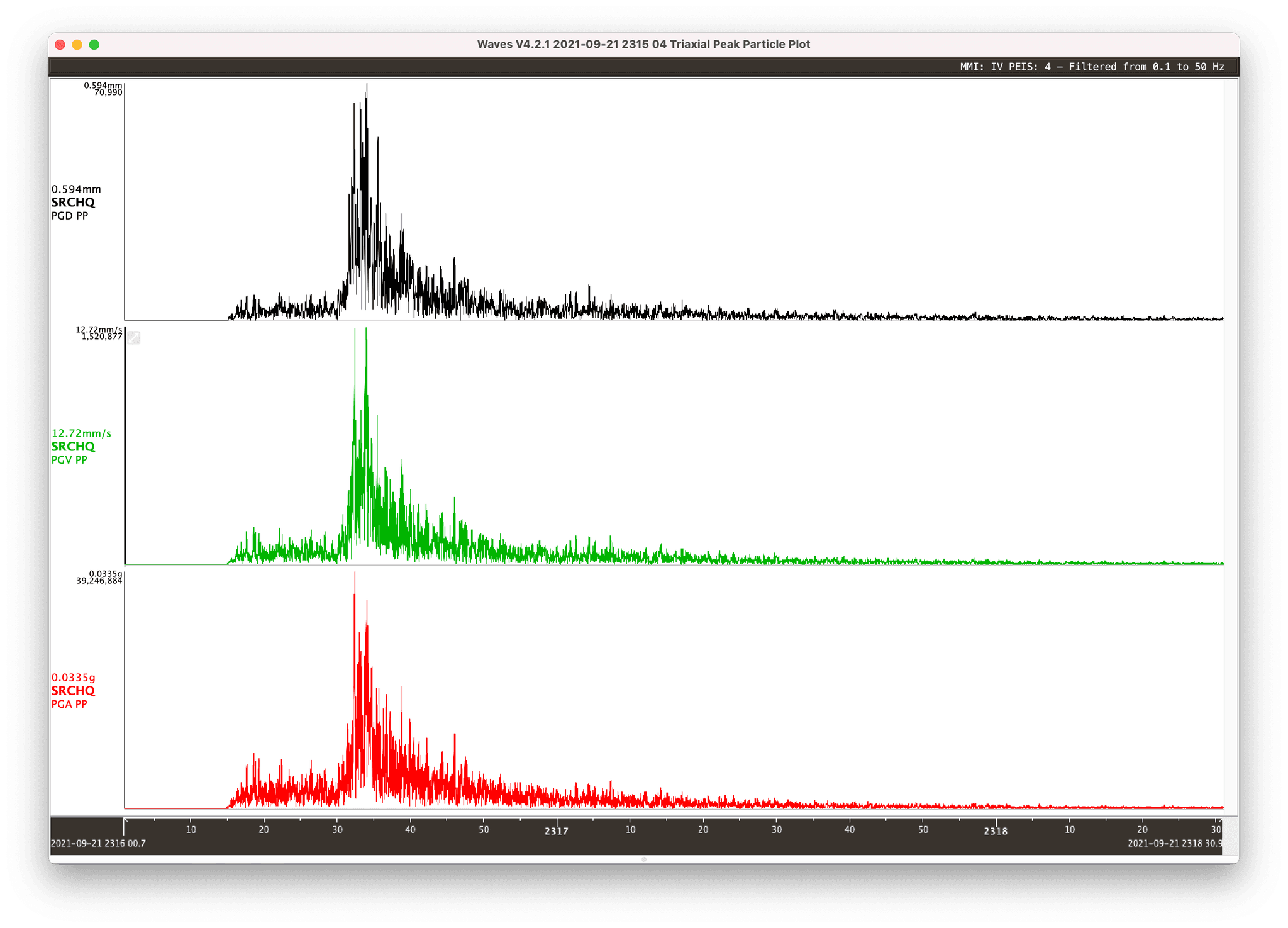
The magnitude MLv5.8 (Mw5.9) earthquake on 22 September 2021 at 9:15am local time was the largest to occur in the state of Victoria since record-keeping began around 200 years ago. The epicentre of the earthquake was located 127km from our office in Melbourne, and was recorded on an old digital seismograph operating in our factory where we manufacture our current range of earthquake recording equipment.
We have generated an isoseismal map of this earthquake based on data collected and contoured by Geoscience Australia. You can find GA’s raw data and more here.
Download the data recorded at the SRC HQ here and download Waves to view and analyse the data.
Below is summary of the earthquake that was prepared by Mark Quigley from the University of Melbourne, in conjunction with the SRC and Geoscience Australia.
INFORMATION SHEET
Release date: 27 September 2021
The moment magnitude (Mw) 5.9 Woods Point earthquake occurred at 9:15 am on Wednesday 22 September 2021 (AEST). More than 150 aftershocks of ML ≥ 1.0 have been recorded in the region as of 7:27 am Saturday 25 September AEST. The largest recorded aftershock is ML 4.2, recorded approximately 15 minutes after the Mw 5.9 mainshock.
The epicentre of this earthquake is approximately latitude -37.506o and longitude 146.402o. The epicentre is located approximately 56 km SE of Mansfield (bearing 150o) and 15 km ENE of Woods Point (bearing 060o). The preferred estimated hypocentre depth of this earthquake is approximately 12.7 km.
The earthquake has been named after the closest population centre (Woods Point) to the epicentre. Indigenous counsel has been sought as to whether a local Indigenous name for this earthquake would be culturally appropriate, and what name could be assigned if this is the case.
The preferred solution for the fault that ruptured in the earthquake is an approximately N-S oriented (bearing 350o), steeply dipping (ca. 85o), left lateral fault rupture.
On the basis of aftershock distributions, the estimated dimensions of the fault are LENGTH = 8 km, WIDTH = 9 km (ca. between 4 km to 13 km depth). The fault rupture process is inferred to be bi-lateral (N and S directed) and dominated by up-dip rupture propagation. The earthquake may have nucleated near the base of the brittle-ductile transition. The estimated average slip on the fault, considering a Mw range of 5.8 to 5.9, is approximately 0.25 to 0.40 m. Ten temporary seismometers were deployed in the aftershock area in 23 to 25 September; they are likely to be left in the field for several weeks.
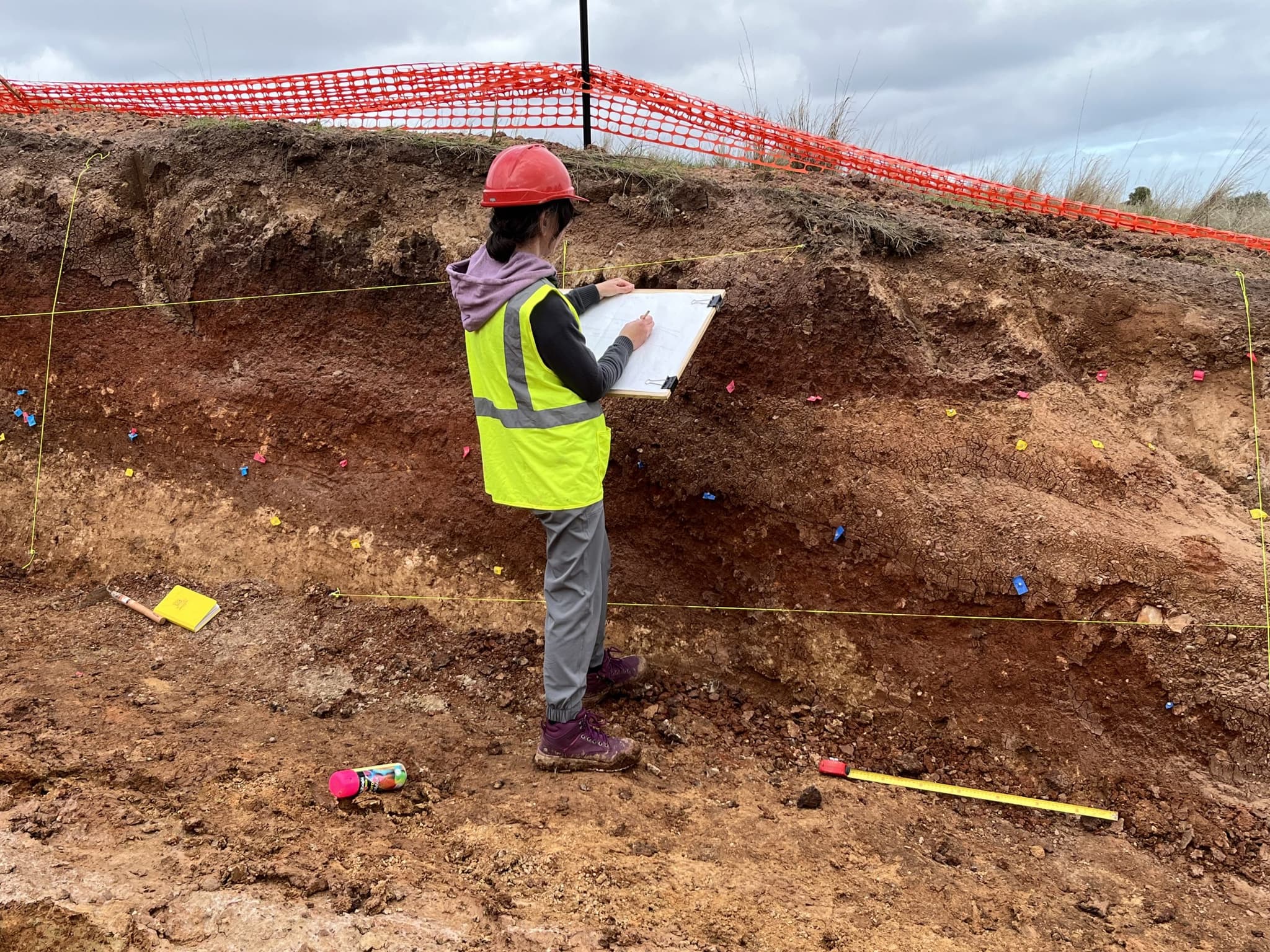
Reconnaissance field inspections were undertaken from Thursday 23 September 2021 to Sunday 26 September 2021. Maps showing the roads and areas covered by field surveys are shown in the Appendix of this document.
Residents in the epicentral area report minimal-to-no structural damage to buildings and infrastructure. Only the most vulnerable of structures (ca. late 1800s to early 1900s unreinforced stone and masonry structures with poor mortar quality and very low capacity) were damaged. Many vulnerable structures were not damaged. Some light objects were displaced from shelves in some locations however many precarious objects were not displaced. Predicted MMIs (based on NGA-east Mw-based ground motion models for PGA) range from MMI > 5.5 to > 6.5 in populated areas within 40 km of the epicentre. Isolated local citizen reports include MMI 7. On the basis of our inspections, we tentatively suggest a MMI = 4 at distances of ca. 70 to 20 km from the epicentre and MMI =5 at distances ≤ 20 km from the epicentre. The most proximal instrumentally recorded horizontal peak ground accelerations are 0.11g, recorded at 63km hypocentral distance. Shaking durations and ground displacements and velocities may also have been relevant in considering the low amounts of damage in the epicentral region. This aspect is being currently investigated in more detail. “Did you feel it data?” can be used to gain deeper insights into the distribution and characteristics of shaking from this earthquake.

Monitoring something similar?
Tell us what you are trying to measure
Describe the site and an ESS engineer will specify the instrument set — usually in one reply.